File:Caldwell_County_Missouri_Courthouse_20191027-7106.jpg
From Wikipedia, the free encyclopedia
Size of this preview: 800 × 518 pixels. Other resolutions: 320 × 207 pixels | 640 × 414 pixels | 1,024 × 663 pixels | 1,280 × 829 pixels | 2,560 × 1,657 pixels | 3,656 × 2,367 pixels.
Original file (3,656 × 2,367 pixels, file size: 5.37 MB, MIME type: image/jpeg)
| This is a file from the Wikimedia Commons. Information from its description page there is shown below. Commons is a freely licensed media file repository. You can help. |
Summary
| DescriptionCaldwell County Missouri Courthouse 20191027-7106.jpg | |
| Date | |
| Source | Own work |
| Author | Kbh3rd |
| Camera location | 39° 38′ 34.39″ N, 94° 02′ 16.91″ W | View this and other nearby images on: OpenStreetMap |
|---|
|
This is an image of a place or building that is listed on the National Register of Historic Places in the United States of America. Its reference number is 72000707. |
Licensing
I, the copyright holder of this work, hereby publish it under the following license:
This file is licensed under the Creative Commons Attribution 4.0 International license.
- You are free:
- to share – to copy, distribute and transmit the work
- to remix – to adapt the work
- Under the following conditions:
- attribution – You must give appropriate credit, provide a link to the license, and indicate if changes were made. You may do so in any reasonable manner, but not in any way that suggests the licensor endorses you or your use.
Captions
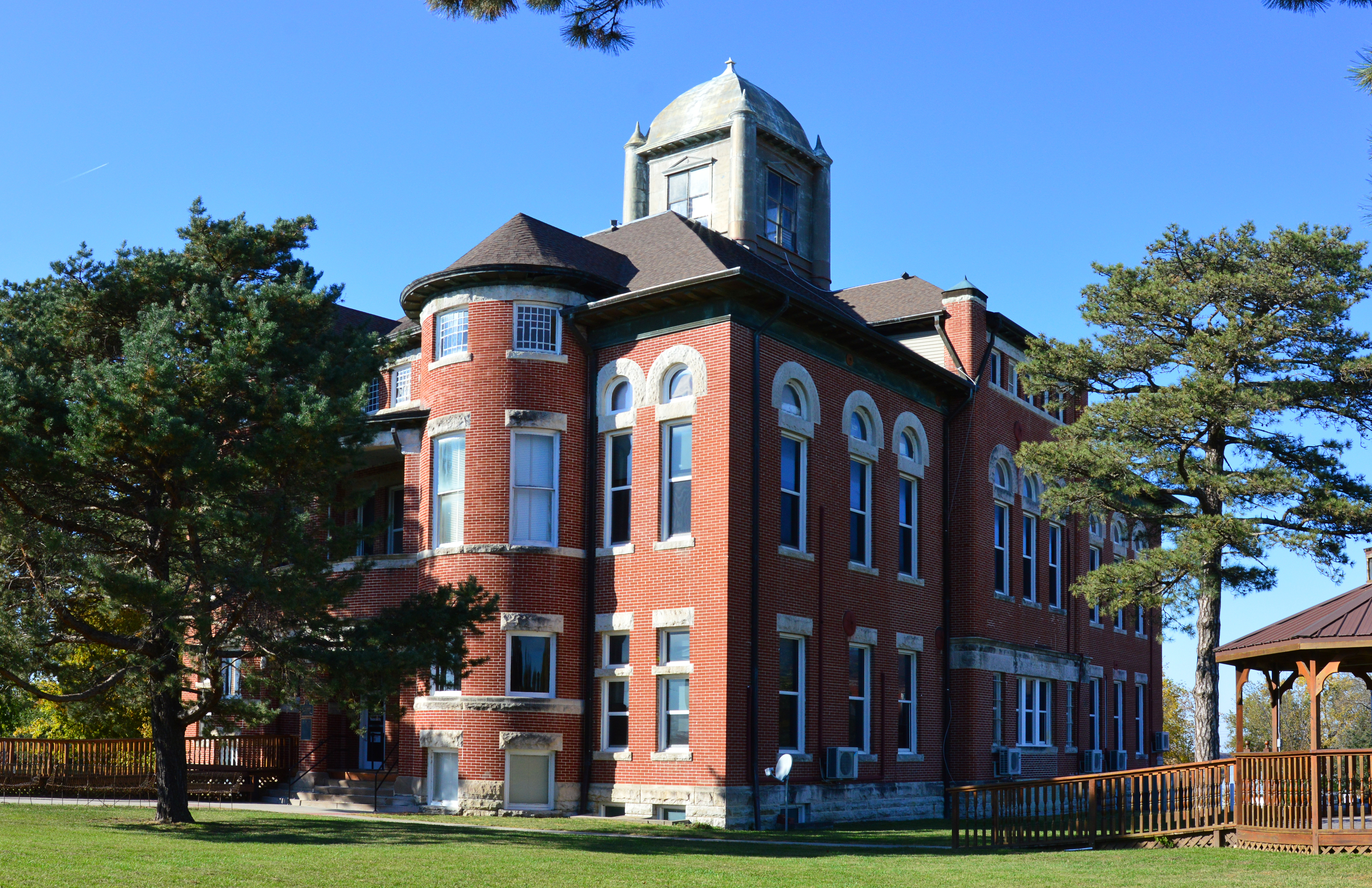
Caldwell County, Missouri, courthouse in Kingston
Items portrayed in this file
depicts
27 October 2019
39°38'34.390"N, 94°2'16.912"W
0.005 second
11
20 millimetre
400
image/jpeg
b66f0a3a0cd816e1367d81743ff351ab82101f8a
5,629,212 byte
2,367 pixel
3,656 pixel
File history
Click on a date/time to view the file as it appeared at that time.
| Date/Time | Thumbnail | Dimensions | User | Comment | |
|---|---|---|---|---|---|
| current | 06:17, 29 October 2019 | | 3,656 × 2,367 (5.37 MB) | Kbh3rd | User created page with UploadWizard |
File usage
The following pages on the English Wikipedia use this file (pages on other projects are not listed):
Global file usage
The following other wikis use this file:
- Usage on ar.wikipedia.org
- Usage on arz.wikipedia.org
- Usage on ca.wikipedia.org
- Usage on ceb.wikipedia.org
- Usage on ce.wikipedia.org
- Usage on cy.wikipedia.org
- Usage on de.wikipedia.org
- Usage on es.wikipedia.org
- Usage on eu.wikipedia.org
- Usage on fr.wikipedia.org
- Usage on ht.wikipedia.org
- Usage on hu.wikipedia.org
- Usage on it.wikipedia.org
- Usage on ko.wikipedia.org
- Usage on ky.wikipedia.org
- Usage on lld.wikipedia.org
- Usage on pl.wikipedia.org
- Usage on pt.wikipedia.org
- Usage on sr.wikipedia.org
- Usage on tr.wikipedia.org
- Usage on tt.wikipedia.org
- Usage on uk.wikipedia.org
- Usage on uz.wikipedia.org
- Usage on www.wikidata.org
Metadata
This file contains additional information, probably added from the digital camera or scanner used to create or digitize it.
If the file has been modified from its original state, some details may not fully reflect the modified file.
| Camera manufacturer | NIKON CORPORATION |
|---|---|
| Camera model | NIKON D3200 |
| Exposure time | 1/200 sec (0.005) |
| F-number | f/11 |
| ISO speed rating | 400 |
| Date and time of data generation | 20:34, 27 October 2019 |
| Lens focal length | 20 mm |
| Latitude | 39° 38′ 34.39″ N |
| Longitude | 94° 2′ 16.91″ W |
| Altitude | 277 meters above sea level |
| City shown | Kingston |
| Credit/Provider | Wikimedia Commons by Kbh3rd |
| Copyright holder | https://en.wikipedia.org/wiki/User:Kbh3rd |
| Image title | Caldwell County, Missouri, courthouse in Kingston |
| Orientation | Normal |
| Horizontal resolution | 300 dpi |
| Vertical resolution | 300 dpi |
| Software used | Ver.1.04 |
| File change date and time | 20:34, 27 October 2019 |
| Y and C positioning | Co-sited |
| Exposure Program | Aperture priority |
| Exif version | 2.3 |
| Date and time of digitizing | 20:34, 27 October 2019 |
| Meaning of each component |
|
| Image compression mode | 4 |
| Exposure bias | 0 |
| Maximum land aperture | 1.6 APEX (f/1.74) |
| Metering mode | Pattern |
| Light source | Unknown |
| Flash | Flash did not fire |
| DateTime subseconds | 00 |
| DateTimeOriginal subseconds | 00 |
| DateTimeDigitized subseconds | 00 |
| Supported Flashpix version | 1 |
| Color space | sRGB |
| Sensing method | One-chip color area sensor |
| File source | Digital still camera |
| Scene type | A directly photographed image |
| Custom image processing | Normal process |
| Exposure mode | Auto exposure |
| White balance | Auto white balance |
| Digital zoom ratio | 1 |
| Focal length in 35 mm film | 30 mm |
| Scene capture type | Standard |
| Scene control | Low gain up |
| Contrast | Normal |
| Saturation | Normal |
| Sharpness | Normal |
| Subject distance range | Unknown |
| GPS time (atomic clock) | 20:34 |
| Reference for direction of image | True direction |
| Direction of image | 0 |
| Geodetic survey data used | WGS-84 |
| GPS date | 27 October 2019 |
| GPS tag version | 2.3.0.0 |
| Special instructions | Lat 39.6428861111111, Lon -94.0380305555556 - Bearing: 0 - Altitude: 277m |
| IIM version | 4 |
| Sublocation of city shown | 49 East Main Street |
| Province or state shown | Missouri |
| Country shown | US |