File:Bridleway,_Falmer_Hill_-_geograph.org.uk_-_62988.jpg
From Wikipedia, the free encyclopedia
No higher resolution available.
Bridleway,_Falmer_Hill_-_geograph.org.uk_-_62988.jpg (640 × 479 pixels, file size: 182 KB, MIME type: image/jpeg)
| This is a file from the Wikimedia Commons. Information from its description page there is shown below. Commons is a freely licensed media file repository. You can help. |
Summary
| DescriptionBridleway, Falmer Hill - geograph.org.uk - 62988.jpg |
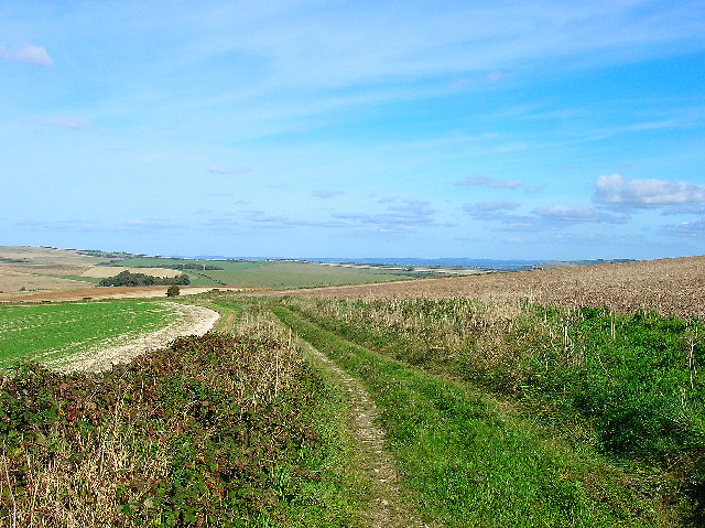
English: Bridleway, Falmer Hill. Looking east. The B2133 can be made out in the middle distance, beyond that the wood is Newmarket Plantation and in the further distance the High Weald can be seen. |
| Date | |
| Source | From geograph.org.uk |
| Author | Simon Carey |
| Attribution (required by the license) InfoField | Simon Carey / Bridleway, Falmer Hill / |
InfoField | Simon Carey / Bridleway, Falmer Hill |
| Camera location | 50° 51′ 06″ N, 0° 04′ 52″ W | View this and other nearby images on: OpenStreetMap |
|---|
| Object location | 50° 51′ 12″ N, 0° 04′ 37″ W | View this and other nearby images on: OpenStreetMap |
|---|
Licensing

|
This image was taken from the Geograph project collection. See this photograph's page on the Geograph website for the photographer's contact details. The copyright on this image is owned by Simon Carey and is licensed for reuse under the Creative Commons Attribution-ShareAlike 2.0 license.
|
This file is licensed under the Creative Commons Attribution-Share Alike 2.0 Generic license.
Attribution: Simon Carey
- You are free:
- to share – to copy, distribute and transmit the work
- to remix – to adapt the work
- Under the following conditions:
- attribution – You must give appropriate credit, provide a link to the license, and indicate if changes were made. You may do so in any reasonable manner, but not in any way that suggests the licensor endorses you or your use.
- share alike – If you remix, transform, or build upon the material, you must distribute your contributions under the same or compatible license as the original.
Captions
Add a one-line explanation of what this file represents
Items portrayed in this file
depicts
some value
9 October 2005
50°51'6.1"N, 0°4'51.6"W
50°51'12.2"N, 0°4'37.2"W
image/jpeg
4ee30fe9e74bd8d5ce7a1d90734615c3e230c555
186,520 byte
479 pixel
640 pixel
File history
Click on a date/time to view the file as it appeared at that time.
| Date/Time | Thumbnail | Dimensions | User | Comment | |
|---|---|---|---|---|---|
| current | 13:34, 30 January 2010 | | 640 × 479 (182 KB) | GeographBot | == {{int:filedesc}} == {{Information |description={{en|1=Bridleway, Falmer Hill. Looking east. The B2133 can be made out in the middle distance, beyond that the wood is Newmarket Plantation and in the further distance the High Weald can be seen.}} |date=2 |
File usage
The following pages on the English Wikipedia use this file (pages on other projects are not listed):
Metadata
This file contains additional information, probably added from the digital camera or scanner used to create or digitize it.
If the file has been modified from its original state, some details may not fully reflect the modified file.
| Camera manufacturer | NIKON |
|---|---|
| Camera model | E4600 |
| Exposure time | 27,027/10,000,000 sec (0.0027027) |
| F-number | f/5.2 |
| ISO speed rating | 50 |
| Date and time of data generation | 14:18, 9 October 2005 |
| Lens focal length | 7 mm |
| Orientation | Normal |
| Horizontal resolution | 300 dpi |
| Vertical resolution | 300 dpi |
| Software used | PictureProject 1.1.0 M |
| File change date and time | 16:37, 9 October 2005 |
| Y and C positioning | Centered |
| Exposure Program | Normal program |
| Exif version | 2.2 |
| Date and time of digitizing | 14:18, 9 October 2005 |
| Exposure bias | 0 |
| Maximum land aperture | 3 APEX (f/2.83) |
| Metering mode | Pattern |
| Light source | Unknown |
| Flash | Flash did not fire, auto mode |
| Color space | sRGB |