File:Basingstoke_Canal_near_Brookwood_-_geograph.org.uk_-_277509.jpg
From Wikipedia, the free encyclopedia
No higher resolution available.
Basingstoke_Canal_near_Brookwood_-_geograph.org.uk_-_277509.jpg (640 × 480 pixels, file size: 133 KB, MIME type: image/jpeg)
| This is a file from the Wikimedia Commons. Information from its description page there is shown below. Commons is a freely licensed media file repository. You can help. |
Summary
| DescriptionBasingstoke Canal near Brookwood - geograph.org.uk - 277509.jpg |
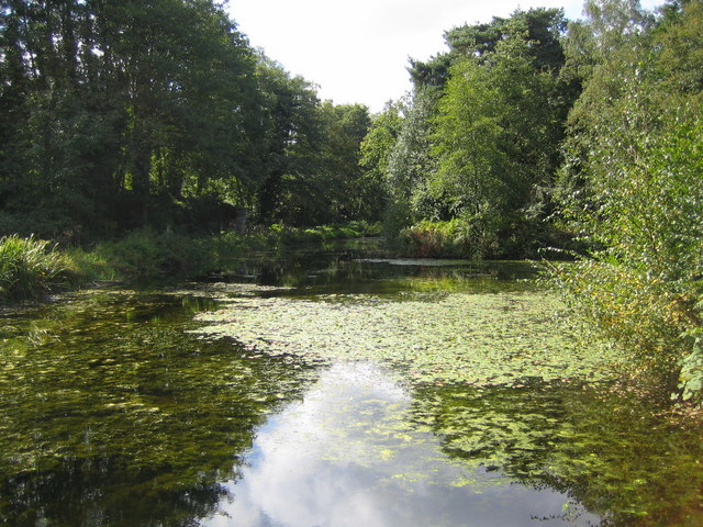
English: Basingstoke Canal near Brookwood Looking upstream from the lock at Pirbright Bridge and the Brunswick Road crossing, the area of water to the right is a turning basin. The Canal's website is here http://www.basingstoke-canal.org.uk/front.htm |
| Date | |
| Source | From geograph.org.uk |
| Author | Nigel Cox |
| Attribution (required by the license) InfoField | Nigel Cox / Basingstoke Canal near Brookwood / |
InfoField | Nigel Cox / Basingstoke Canal near Brookwood |
| Object location | 51° 18′ 14″ N, 0° 38′ 53″ W | View this and other nearby images on: OpenStreetMap |
|---|
Licensing

|
This image was taken from the Geograph project collection. See this photograph's page on the Geograph website for the photographer's contact details. The copyright on this image is owned by Nigel Cox and is licensed for reuse under the Creative Commons Attribution-ShareAlike 2.0 license.
|
This file is licensed under the Creative Commons Attribution-Share Alike 2.0 Generic license.
Attribution: Nigel Cox
- You are free:
- to share – to copy, distribute and transmit the work
- to remix – to adapt the work
- Under the following conditions:
- attribution – You must give appropriate credit, provide a link to the license, and indicate if changes were made. You may do so in any reasonable manner, but not in any way that suggests the licensor endorses you or your use.
- share alike – If you remix, transform, or build upon the material, you must distribute your contributions under the same or compatible license as the original.
- Remove redundant categories and try to put this image in the most specific category/categories
- Remove this template
- The location categories are based on information from this geonames tool and this OpenStreetMap tool combined with a database. You can also have a look at this tool from mysociety.
- The topic category from Geograph was Canal (find similar images at Geograph)
English | suomi | français | galego | עברית | magyar | македонски | മലയാളം | português | português do Brasil | Türkçe | +/−
Captions
Add a one-line explanation of what this file represents
Items portrayed in this file
depicts
some value
20 September 2006
51°18'14.0"N, 0°38'52.8"W
image/jpeg
c4903a5f56ae81e89ae3a0f52b6de79f9781548f
136,453 byte
480 pixel
640 pixel
File history
Click on a date/time to view the file as it appeared at that time.
| Date/Time | Thumbnail | Dimensions | User | Comment | |
|---|---|---|---|---|---|
| current | 19:10, 12 December 2010 | | 640 × 480 (133 KB) | GeographBot | == {{int:filedesc}} == {{Information |description={{en|1=Basingstoke Canal near Brookwood Looking upstream from the lock at Pirbright Bridge and the Brunswick Road crossing, the area of water to the right is a turning basin. The Canal's website is here ht |
File usage
The following pages on the English Wikipedia use this file (pages on other projects are not listed):
Global file usage
The following other wikis use this file:
- Usage on fa.wikipedia.org
Metadata
This file contains additional information, probably added from the digital camera or scanner used to create or digitize it.
If the file has been modified from its original state, some details may not fully reflect the modified file.
| Camera manufacturer | Canon |
|---|---|
| Camera model | Canon DIGITAL IXUS 40 |
| Exposure time | 1/500 sec (0.002) |
| F-number | f/2.8 |
| Date and time of data generation | 12:16, 20 September 2006 |
| Lens focal length | 5.8 mm |
| Orientation | Normal |
| Horizontal resolution | 180 dpi |
| Vertical resolution | 180 dpi |
| File change date and time | 12:16, 20 September 2006 |
| Y and C positioning | Centered |
| Exif version | 2.2 |
| Date and time of digitizing | 12:16, 20 September 2006 |
| Image compression mode | 3 |
| Shutter speed | 8.96875 |
| APEX aperture | 2.96875 |
| Exposure bias | 0 |
| Maximum land aperture | 2.96875 APEX (f/2.8) |
| Metering mode | Pattern |
| Flash | Flash did not fire, auto mode |
| Color space | sRGB |
| Focal plane X resolution | 10,142.857142857 |
| Focal plane Y resolution | 10,142.857142857 |
| Focal plane resolution unit | inches |
| Sensing method | One-chip color area sensor |
| Custom image processing | Normal process |
| Exposure mode | Auto exposure |
| White balance | Auto white balance |
| Digital zoom ratio | 1 |
| Scene capture type | Standard |