File:Azerbaijan-CIA_WFB_Map.png
From Wikipedia, the free encyclopedia
Aj-map.png (325 × 349 pixels, file size: 13 KB, MIME type: image/png)
| This is a file from the Wikimedia Commons. Information from its description page there is shown below. Commons is a freely licensed media file repository. You can help. |
Summary
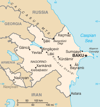
| DescriptionAj-map.png |
Türkçe: Azerbaycan'ın CIA tarafından oluşturulmuş haritası |
| Date | |
| Source | CIA World Factbook |
| Author | United States Central Intelligence Agency |
Licensing
| Public domainPublic domainfalsefalse |
This image is in the public domain because it contains materials that originally came from the United States Central Intelligence Agency's World Factbook.
Bahasa Indonesia ∙ čeština ∙ Deutsch ∙ eesti ∙ English ∙ español ∙ Esperanto ∙ français ∙ galego ∙ hrvatski ∙ italiano ∙ Nederlands ∙ norsk nynorsk ∙ polski ∙ português ∙ sicilianu ∙ slovenščina ∙ suomi ∙ Türkçe ∙ Zazaki ∙ беларуская (тарашкевіца) ∙ македонски ∙ русский ∙ српски / srpski ∙ українська ∙ ქართული ∙ বাংলা ∙ தமிழ் ∙ മലയാളം ∙ 한국어 ∙ 日本語 ∙ 中文 ∙ 中文(简体) ∙ 中文(繁體) ∙ العربية ∙ +/− |
 |
Derivative works
Derivative works of this file: Mapa de Azerbaiyán.png
| Annotations InfoField | This image is annotated: View the annotations at Commons |
Məhrəsə monastırı
Captions
Items portrayed in this file
depicts
26 February 2005
image/png
f2f25231d051ace2511366a2631d897c1e6f0db5
13,507 byte
349 pixel
325 pixel
File history
Click on a date/time to view the file as it appeared at that time.
| Date/Time | Thumbnail | Dimensions | User | Comment | |
|---|---|---|---|---|---|
| current | 07:44, 19 February 2022 | | 325 × 349 (13 KB) | Lojwe | Cropped 1 % horizontally, 1 % vertically using CropTool with precise mode. |
| 12:44, 5 August 2015 |  | 328 × 352 (14 KB) | Ray Garraty | Reverted to version as of 22:26, 26 February 2005 | |
| 12:11, 5 August 2015 |  | 328 × 352 (43 KB) | Szczureq | Added border of Armenian-controlled Nagorno-Karabakh territory | |
| 22:26, 26 February 2005 |  | 328 × 352 (14 KB) | Alfio | Cia map of Azerbaijan |
File usage
- Absheron gas field
- Ashrafi field
- Azerbaijan International Operating Company
- Azerenerji
- Azeri oilfield
- Azeri–Chirag–Gunashli
- Azpetrol
- Bahar oilfield
- Branobel
- Caspian International Petroleum Company
- Chirag oilfield
- Dan Ulduzu field
- Darwin Bank
- Dunsterforce
- Energy in Azerbaijan
- Extreme points of Azerbaijan
- Gum Deniz oilfield
- Gunashli oilfield
- Heydar Aliyev Baku Oil Refinery
- Karabakh oilfield
- List of airports in Azerbaijan
- Ministry of Energy (Azerbaijan)
- Nakhchivan field
- Nobel Energy
- North Absheron Operating Company
- SOCAR
- Shafag-Asiman gas field
- Shah Deniz gas field
- Shallow Water Absheron Peninsula
- Umid gas field
- Template:Energy in Azerbaijan
- Portal:Azerbaijan
- Portal:Azerbaijan/Azerbaijan-related topics
- Module:Location map/data/Azerbaijan
- Module:Location map/data/Azerbaijan/doc
Global file usage
The following other wikis use this file:
- Usage on ab.wikipedia.org
- Usage on af.wikipedia.org
- Usage on ast.wikipedia.org
- Usage on av.wikipedia.org
- Usage on azb.wikipedia.org
- Usage on az.wikipedia.org
- Usage on be-tarask.wikipedia.org
- Usage on be.wikipedia.org
- Usage on bg.wikipedia.org
- Usage on bg.wiktionary.org
- Usage on br.wikipedia.org
- Usage on bs.wikipedia.org
- Usage on ca.wikipedia.org
- Usage on cs.wikipedia.org
- Usage on cv.wikipedia.org
- Usage on da.wikipedia.org
- Usage on de.wikipedia.org
- Usage on dsb.wikipedia.org
- Usage on el.wikipedia.org
- Usage on en.wikinews.org
- Usage on en.wikisource.org
- Usage on en.wiktionary.org
- Usage on eo.wikipedia.org
- Usage on es.wikipedia.org
- Usage on es.wikinews.org
- Usage on fa.wikipedia.org
- Usage on ff.wikipedia.org
- Usage on fr.wikipedia.org
View more global usage of this file.
Metadata
This file contains additional information, probably added from the digital camera or scanner used to create or digitize it.
If the file has been modified from its original state, some details may not fully reflect the modified file.
| File change date and time | 07:43, 19 February 2022 |
|---|