File:Au-map.png
From Wikipedia, the free encyclopedia
Au-map.png (400 × 429 pixels, file size: 30 KB, MIME type: image/png)
| This is a file from the Wikimedia Commons. Information from its description page there is shown below. Commons is a freely licensed media file repository. You can help. |
| This file is an original and may be obsolete for general use, but is kept for historical or archival use. As such, it should not be modified or deleted except to correct upload or technical errors. Any modified versions or replacements of this image should be uploaded with a different file name. Information about this file: 2004 version العربيَّة ∙ čeština ∙ Deutsch ∙ English ∙ español ∙ فارسی ∙ français ∙ magyar ∙ italiano ∙ 日本語 ∙ Lëtzebuergesch ∙ македонски ∙ മലയാളം ∙ Nederlands ∙ português ∙ русский ∙ slovenščina ∙ svenska ∙ 简体中文 ∙ 繁體中文 ∙ 正體中文(臺灣) ∙ +/− |
Summary
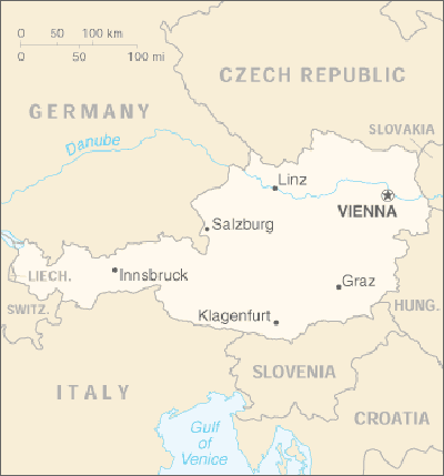
| DescriptionAu-map.png | |
| Date | |
| Source | CIA World Factbook |
| Author | United States Central Intelligence Agency |
| Other versions |
Licensing
| Public domainPublic domainfalsefalse |
This image is in the public domain because it contains materials that originally came from the United States Central Intelligence Agency's World Factbook.
Bahasa Indonesia ∙ čeština ∙ Deutsch ∙ eesti ∙ English ∙ español ∙ Esperanto ∙ français ∙ galego ∙ hrvatski ∙ italiano ∙ Nederlands ∙ norsk nynorsk ∙ polski ∙ português ∙ sicilianu ∙ slovenščina ∙ suomi ∙ Türkçe ∙ Zazaki ∙ беларуская (тарашкевіца) ∙ македонски ∙ русский ∙ српски / srpski ∙ українська ∙ ქართული ∙ বাংলা ∙ தமிழ் ∙ മലയാളം ∙ 한국어 ∙ 日本語 ∙ 中文 ∙ 中文(简体) ∙ 中文(繁體) ∙ العربية ∙ +/− |
 |
Derivative works
-
 Au-map-FR.png
français -
 Austria map es.png
español -
 Au-map zh.png
中文 -
 Au-map vi.png
Tiếng Việt -
 Au-map-sl.png
slovenščina


.png)
Captions
Items portrayed in this file
depicts
2004
image/png
1fb8f114424cb0fc66b07671c39833aaac009202
30,905 byte
429 pixel
400 pixel
File history
Click on a date/time to view the file as it appeared at that time.
| Date/Time | Thumbnail | Dimensions | User | Comment | |
|---|---|---|---|---|---|
| current | 20:44, 25 March 2020 | | 400 × 429 (30 KB) | Kontrollstellekundl | min. size 400 |
| 05:33, 26 March 2006 |  | 351 × 377 (15 KB) | Happenstance | Overwriting map of Andorra, must have been uploaded by a mistake, all pointing pages are pages on Austria {{PD-USGov-CIA-WF}} | |
| 13:38, 25 March 2006 |  | 330 × 355 (6 KB) | Hipi Zhdripi~commonswiki | Reverted to earlier revision | |
| 13:30, 25 March 2006 |  | 351 × 377 (15 KB) | Hipi Zhdripi~commonswiki | Reverted to earlier revision | |
| 10:40, 25 March 2006 |  | 330 × 355 (6 KB) | Hipi Zhdripi~commonswiki | ||
| 20:24, 27 November 2004 |  | 351 × 377 (15 KB) | Kneiphof | Austria CIA map |
File usage
Global file usage
The following other wikis use this file:
- Usage on el.wikipedia.org
- Usage on en.wikiversity.org
- Usage on pl.wikipedia.org
- Usage on sl.wikipedia.org
- Usage on sq.wikipedia.org
- Usage on ug.wikipedia.org
- Usage on zh-min-nan.wikipedia.org
Metadata
This file contains additional information, probably added from the digital camera or scanner used to create or digitize it.
If the file has been modified from its original state, some details may not fully reflect the modified file.
| Horizontal resolution | 45.28 dpc |
|---|---|
| Vertical resolution | 45.28 dpc |