File:Approaching_Horns_Bridge_on_A61_-_geograph.org.uk_-_605196.jpg
From Wikipedia, the free encyclopedia
No higher resolution available.
Approaching_Horns_Bridge_on_A61_-_geograph.org.uk_-_605196.jpg (640 × 407 pixels, file size: 41 KB, MIME type: image/jpeg)
| This is a file from the Wikimedia Commons. Information from its description page there is shown below. Commons is a freely licensed media file repository. You can help. |
Summary
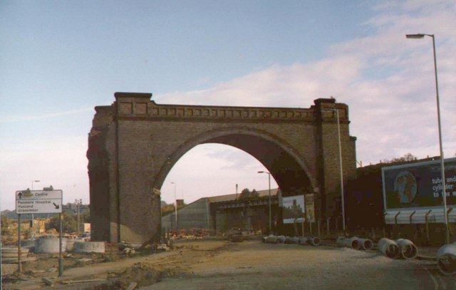
| DescriptionApproaching Horns Bridge on A61 - geograph.org.uk - 605196.jpg | |
| Date | |
| Source | From geograph.org.uk |
| Author | Alan Heardman |
| Attribution (required by the license) InfoField | Alan Heardman / Approaching Horns Bridge on A61 / |
InfoField | Alan Heardman / Approaching Horns Bridge on A61 |
| Camera location | 53° 13′ 50″ N, 1° 25′ 22″ W | View this and other nearby images on: OpenStreetMap |
|---|
| Object location | 53° 13′ 51″ N, 1° 25′ 23″ W | View this and other nearby images on: OpenStreetMap |
|---|
Licensing

|
This image was taken from the Geograph project collection. See this photograph's page on the Geograph website for the photographer's contact details. The copyright on this image is owned by Alan Heardman and is licensed for reuse under the Creative Commons Attribution-ShareAlike 2.0 license.
|
This file is licensed under the Creative Commons Attribution-Share Alike 2.0 Generic license.
Attribution: Alan Heardman
- You are free:
- to share – to copy, distribute and transmit the work
- to remix – to adapt the work
- Under the following conditions:
- attribution – You must give appropriate credit, provide a link to the license, and indicate if changes were made. You may do so in any reasonable manner, but not in any way that suggests the licensor endorses you or your use.
- share alike – If you remix, transform, or build upon the material, you must distribute your contributions under the same or compatible license as the original.
- Remove redundant categories and try to put this image in the most specific category/categories
- Remove this template
- The location categories are based on information from this geonames tool and this OpenStreetMap tool combined with a database. You can also have a look at this tool from mysociety.
- The topic category from Geograph was Railway (dismantled) (find similar images (dismantled) at Geograph)
English | suomi | français | galego | עברית | magyar | македонски | മലയാളം | português | português do Brasil | Türkçe | +/−
Captions
Add a one-line explanation of what this file represents
Items portrayed in this file
depicts
some value
53°13'49.66"N, 1°25'22.08"W
1984
53°13'51.28"N, 1°25'22.80"W
image/jpeg
e6da86638be2c1ead062569b198ced89bef94d07
42,131 byte
407 pixel
640 pixel
File history
Click on a date/time to view the file as it appeared at that time.
| Date/Time | Thumbnail | Dimensions | User | Comment | |
|---|---|---|---|---|---|
| current | 22:23, 6 February 2011 | | 640 × 407 (41 KB) | GeographBot | == {{int:filedesc}} == {{Information |description={{en|1=Approaching Horns Bridge on A61 This picture was taken during an earlier re-development of the area in the early 1980's. 605192 605199}} |date=1984 |source=From [http://www.geograph.org.uk |
File usage
The following pages on the English Wikipedia use this file (pages on other projects are not listed):
Global file usage
The following other wikis use this file:
- Usage on www.wikidata.org
Metadata
This file contains additional information, probably added from the digital camera or scanner used to create or digitize it.
If the file has been modified from its original state, some details may not fully reflect the modified file.
| _error | 0 |
|---|