File:Afghanistan-CIA_WFB_Map.png
From Wikipedia, the free encyclopedia
Afghanistan-CIA_WFB_Map.png (326 × 349 pixels, file size: 15 KB, MIME type: image/png)
| This is a file from the Wikimedia Commons. Information from its description page there is shown below. Commons is a freely licensed media file repository. You can help. |
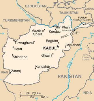
| DescriptionAfghanistan-CIA WFB Map.png | National map image from the 2004 CIA World Fact Book | ||||
| Date | 11 April 2006 (original upload date) | ||||
| Source | Originally from en.wikisource; description page was here. | ||||
| Author | Original uploader was Zhaladshar at en.wikisource | ||||
| Permission (Reusing this file) |
|
||||
| Other versions |
[edit]
UNOCHA Versions
CIA WFB Versions
Other English Versions |

_-_AFG_-_UNOCHA.svg)
_-_AFG_-_UNOCHA-bn.svg)
_-_AFG_-_UNOCHA-es.svg)


| This file is an original and may be obsolete for general use, but is kept for historical or archival use. As such, it should not be modified or deleted except to correct upload or technical errors. Any modified versions or replacements of this image should be uploaded with a different file name. A version of this file more suitable for general use can be found at File:CIA map of Afghanistan in 2007.gif. Information about this file: 2004 version العربيَّة ∙ čeština ∙ Deutsch ∙ English ∙ español ∙ فارسی ∙ français ∙ magyar ∙ italiano ∙ 日本語 ∙ Lëtzebuergesch ∙ македонски ∙ മലയാളം ∙ Nederlands ∙ português ∙ русский ∙ slovenščina ∙ svenska ∙ 简体中文 ∙ 繁體中文 ∙ 正體中文(臺灣) ∙ +/− |
Original upload log
(All user names refer to en.wikisource)
- 2006-04-11 17:11 Zhaladshar 329×352×8 (13080 bytes) National map image from the 2004 CIA World Fact Book
Captions
Items portrayed in this file
depicts
image/png
799a347c09d3dd99484f0c07ca3acfc183702866
15,443 byte
349 pixel
326 pixel
File history
Click on a date/time to view the file as it appeared at that time.
| Date/Time | Thumbnail | Dimensions | User | Comment | |
|---|---|---|---|---|---|
| current | 19:09, 30 October 2021 | | 326 × 349 (15 KB) | Auguel | Remove frame |
| 12:16, 4 September 2007 |  | 329 × 352 (13 KB) | John Vandenberg | {{Information |Description=National map image from the 2004 CIA World Fact Book |Source=Originally from [http://en.wikisource.org en.wikisource]; description page is/was [http://en.wikisource.org/w/index.php?title=Image%3AAfghanistan-CIA_WFB_Map.png here] |
File usage
Global file usage
The following other wikis use this file:
- Usage on ar.wikipedia.org
- Usage on bn.wikipedia.org
- Usage on bs.wikipedia.org
- Usage on ca.wikipedia.org
- Usage on de.wikipedia.org
- Usage on en.wikisource.org
- Usage on es.wikipedia.org
- Usage on fa.wikipedia.org
- Usage on hi.wikipedia.org
- Usage on ilo.wikipedia.org
- Usage on incubator.wikimedia.org
- Template:Wp/bcc/Location map Afghanistan2
- Template:Wp/bcc/Location map Afghanistan2/doc
- Module:Wp/bgn/Location map/data/Afghanistan
- Module:Wp/bgn/Location map/data/Afghanistan/doc
- Module:Wp/khw/Location map/data/Afghanistan
- Module:Wp/lki/Location map/data/Afghanistan
- Module:Wp/lki/Location map/data/Afghanistan/doc
- Module:Wp/khw/Location map/data/Afghanistan/doc
- Usage on ja.wikipedia.org
- Usage on ko.wikipedia.org
- Usage on lt.wiktionary.org
- Usage on my.wikipedia.org
- Usage on or.wikipedia.org
- Usage on pa.wikipedia.org
- Usage on ps.wikipedia.org
- Usage on pt.wikipedia.org
- Usage on sat.wikipedia.org
- Usage on sd.wikipedia.org
- Usage on simple.wikipedia.org
View more global usage of this file.
Metadata
This file contains additional information, probably added from the digital camera or scanner used to create or digitize it.
If the file has been modified from its original state, some details may not fully reflect the modified file.
| Software used | Adobe Photoshop 22.3 (Windows) |
|---|---|
| Date and time of digitizing | 23:08, 30 October 2021 |
| File change date and time | 23:09, 30 October 2021 |
| Date metadata was last modified | 23:09, 30 October 2021 |
| Unique ID of original document | xmp.did:336f7d6e-4463-ef4f-aa39-ff4fa8cfbafb |
| Horizontal resolution | 28.35 dpc |
| Vertical resolution | 28.35 dpc |