File:Aerial_view_of_the_U.S._Naval_Air_Station_Cubi_Point,_Philippines,_on_6_February_1988_(6482943).jpg
From Wikipedia, the free encyclopedia
Size of this preview: 799 × 600 pixels. Other resolutions: 320 × 240 pixels | 640 × 480 pixels | 1,023 × 768 pixels | 1,280 × 961 pixels | 2,560 × 1,922 pixels | 3,000 × 2,252 pixels.
Original file (3,000 × 2,252 pixels, file size: 2.2 MB, MIME type: image/jpeg)
| This is a file from the Wikimedia Commons. Information from its description page there is shown below. Commons is a freely licensed media file repository. You can help. |
Summary
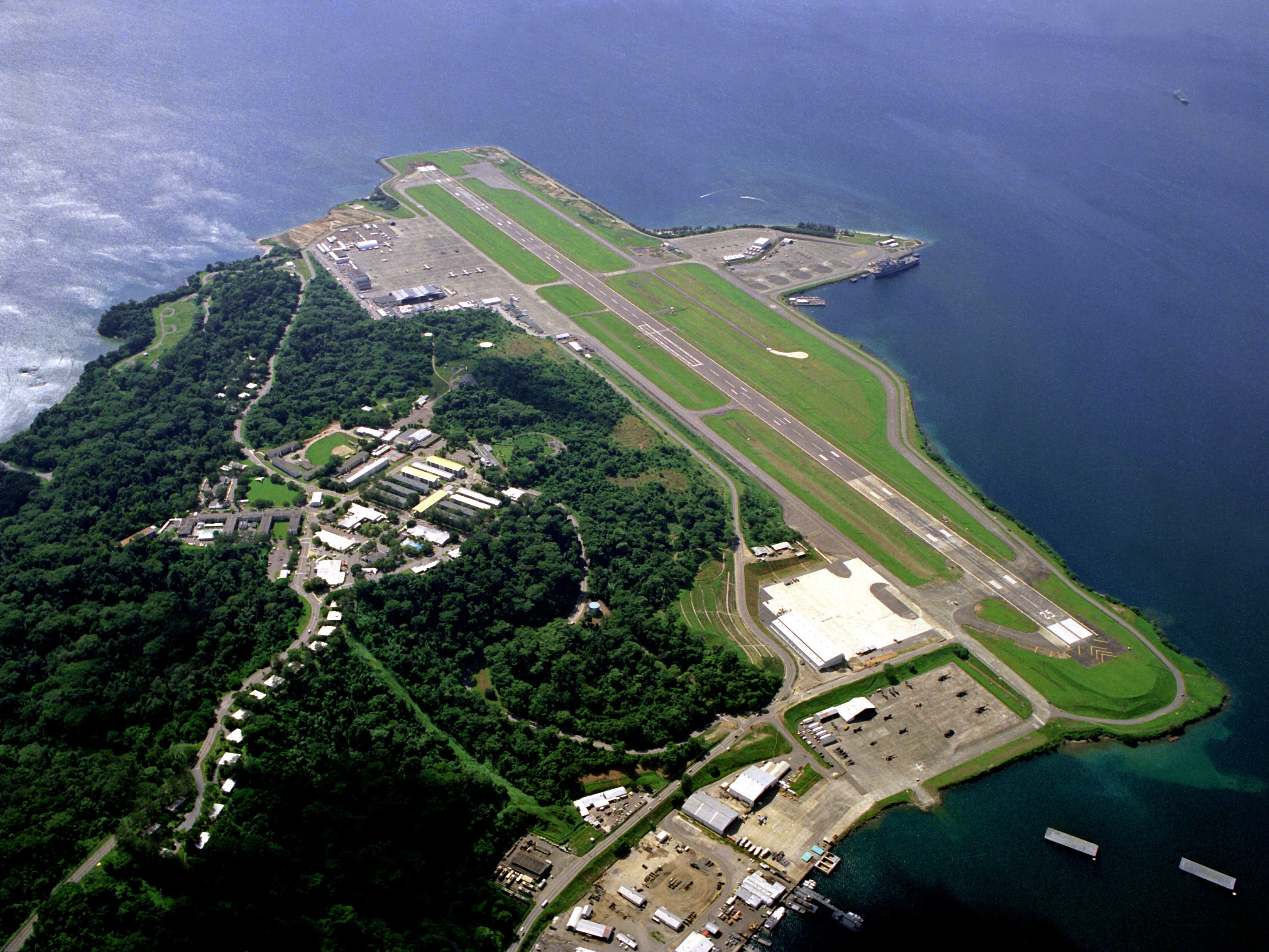
| DescriptionAerial view of the U.S. Naval Air Station Cubi Point, Philippines, on 6 February 1988 (6482943).jpg |
English: An aerial view of the runway and flight line of the U.S. Naval Air Station Cubi Point, Philippines, on 6 February 1988. |
|||
| Date | ||||
| Source |
|
|||
| Author | PH2(NAC) David Sanner, U.S. Navy |
| Camera location | 14° 47′ 41.57″ N, 120° 16′ 20.03″ E | View this and other nearby images on: OpenStreetMap |
|---|
Licensing
| Public domainPublic domainfalsefalse |
This file is a work of a sailor or employee of the U.S. Navy, taken or made as part of that person's official duties. As a work of the U.S. federal government, it is in the public domain in the United States.
|
 | |
| This file has been identified as being free of known restrictions under copyright law, including all related and neighboring rights. | ||
https://creativecommons.org/publicdomain/mark/1.0/PDMCreative Commons Public Domain Mark 1.0falsefalse
Original upload log
The original description page was here. All following user names refer to en.wikipedia.
- 2006-08-25 12:43 SunKing 3000×2252× (2304748 bytes) ID: DNSC9300780 Service Depicted: Navy An aerial view of the runway and flight line. Location: NAVAL AIR STATION, CUBI POINT, LUZON PHILIPPINES (PHL) Camera Operator: PH2(NAC) DAVID SANNER Date Shot: 6 Feb 1988 {{PD-USGov-Military-Navy}}
Captions
Add a one-line explanation of what this file represents
Items portrayed in this file
depicts
6 February 1988
14°47'41.57"N, 120°16'20.03"E
image/jpeg
e60fa9c2409bf8bf9b355604e994b9414187933b
2,304,748 byte
2,252 pixel
3,000 pixel
File history
Click on a date/time to view the file as it appeared at that time.
| Date/Time | Thumbnail | Dimensions | User | Comment | |
|---|---|---|---|---|---|
| current | 11:50, 5 June 2011 | | 3,000 × 2,252 (2.2 MB) | File Upload Bot (Magnus Manske) | {{BotMoveToCommons|en.wikipedia|year={{subst:CURRENTYEAR}}|month={{subst:CURRENTMONTHNAME}}|day={{subst:CURRENTDAY}}}} {{Information |Description={{en|ID: DNSC9300780 Service Depicted: Navy An aerial view of the runway and flight line. Location: NAVA |
File usage
The following pages on the English Wikipedia use this file (pages on other projects are not listed):
Global file usage
The following other wikis use this file:
- Usage on ceb.wikipedia.org
- Usage on es.wikipedia.org
- Usage on eu.wikipedia.org
- Usage on fa.wikipedia.org
- Usage on fr.wikipedia.org
- Usage on hu.wikipedia.org
- Usage on id.wikipedia.org
- Usage on it.wikipedia.org
- Usage on ja.wikipedia.org
- Usage on ms.wikipedia.org
- Usage on nl.wikipedia.org
- Usage on pl.wikipedia.org
- Usage on ro.wikipedia.org
- Usage on sv.wikipedia.org
- Usage on th.wikipedia.org
- Usage on tl.wikipedia.org
- Usage on vi.wikipedia.org
- Usage on www.wikidata.org
Metadata
This file contains additional information, probably added from the digital camera or scanner used to create or digitize it.
If the file has been modified from its original state, some details may not fully reflect the modified file.
| _error | 0 |
|---|
.jpg)