File:Aerial_view_of_the_Prairie_du_Sac_Dam_during_the_2008_flood.jpg
From Wikipedia, the free encyclopedia
Original file (3,872 × 2,592 pixels, file size: 5.32 MB, MIME type: image/jpeg)
| This is a file from the Wikimedia Commons. Information from its description page there is shown below. Commons is a freely licensed media file repository. You can help. |
Summary
| DescriptionAerial view of the Prairie du Sac Dam during the 2008 flood.jpg |
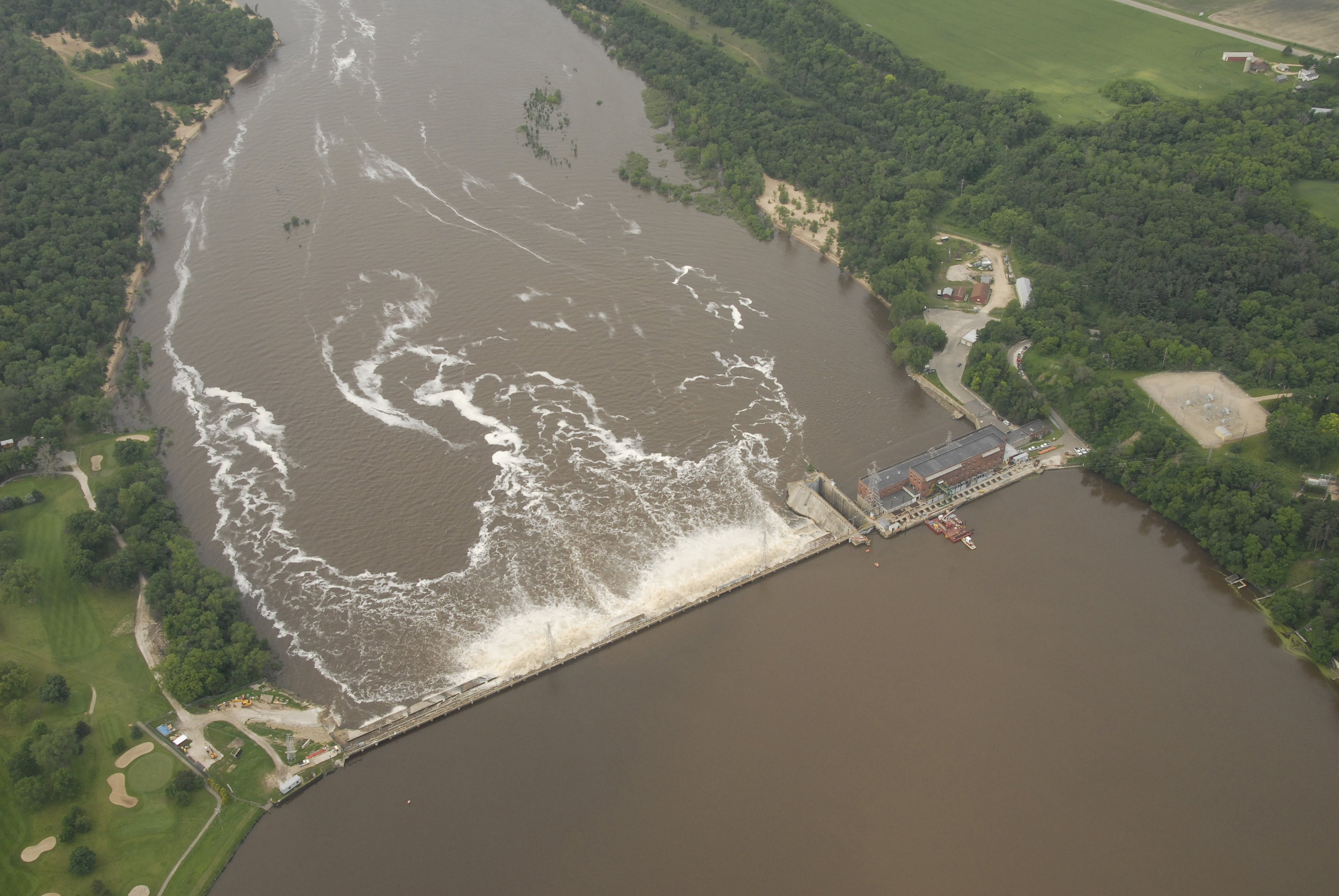
English: An aerial view of the Wisconsin River Dam at Prairie du Sac, Wis., from an UH-60 Blackhawk helicopter June 11, 2008. The dam is one of several dams throughout southern Wisconsin given critical attention in the wake of record rainfalls and widespread flooding. Severe conditions throughout the state prompted Wisconsin Governor Jim Doyle to declare a state of emergency, allowing the Adjutant General, U.S. Air Guard Brigadier General Don Dunbar to activate National Guard troops to assist in the relief effort. (U.S. Air Force photo by Master Sgt. Paul Gorman/Released) |
| Date | |
| Source | www.defenseimagery.mil 080611-F-6967G-006 |
| Author | (U.S. Air Force photo by Master Sgt. Paul Gorman/Released) |
Licensing
| Public domainPublic domainfalsefalse |
This image or file is a work of a U.S. Air Force Airman or employee, taken or made as part of that person's official duties. As a work of the U.S. federal government, the image or file is in the public domain in the United States.
العربية ∙ беларуская (тарашкевіца) ∙ català ∙ čeština ∙ Deutsch ∙ English ∙ español ∙ eesti ∙ فارسی ∙ suomi ∙ français ∙ italiano ∙ 日本語 ∙ 한국어 ∙ македонски ∙ മലയാളം ∙ မြန်မာဘာသာ ∙ norsk bokmål ∙ Plattdüütsch ∙ Nederlands ∙ polski ∙ português ∙ português do Brasil ∙ русский ∙ sicilianu ∙ slovenčina ∙ slovenščina ∙ српски / srpski ∙ svenska ∙ Türkçe ∙ українська ∙ Tiếng Việt ∙ 中文(简体) ∙ 中文(繁體) ∙ +/− |
 |
Captions
Items portrayed in this file
depicts
11 June 2008
0.004 second
11
26 millimetre
400
image/jpeg
38b73d72a500bb363262887be4228a2b992e6d47
5,576,541 byte
2,592 pixel
3,872 pixel
File history
Click on a date/time to view the file as it appeared at that time.
| Date/Time | Thumbnail | Dimensions | User | Comment | |
|---|---|---|---|---|---|
| current | 23:25, 17 June 2008 | | 3,872 × 2,592 (5.32 MB) | Dual Freq | {{Information |Description={{en|1=An aerial view of the Wisconsin River Dam at Prairie du Sac, Wis., from an UH-60 Blackhawk helicopter June 11, 2008. The dam is one of several dams throughout southern Wisconsin given critical attention in the wake of rec |
File usage
Global file usage
The following other wikis use this file:
- Usage on fr.wikipedia.org
- Usage on www.wikidata.org
Metadata
This file contains additional information, probably added from the digital camera or scanner used to create or digitize it.
If the file has been modified from its original state, some details may not fully reflect the modified file.
| Camera manufacturer | NIKON CORPORATION |
|---|---|
| Camera model | NIKON D200 |
| Author | MSgt Paul Gorman |
| Exposure time | 1/250 sec (0.004) |
| F-number | f/11 |
| ISO speed rating | 400 |
| Date and time of data generation | 09:00, 11 June 2008 |
| Lens focal length | 26 mm |
| Orientation | Normal |
| Horizontal resolution | 300 dpi |
| Vertical resolution | 300 dpi |
| Software used | Adobe Photoshop CS2 Windows |
| File change date and time | 00:00, 11 June 2008 |
| Y and C positioning | Co-sited |
| Exposure Program | Aperture priority |
| Exif version | 2.21 |
| Date and time of digitizing | 00:00, 11 June 2008 |
| Image compression mode | 4 |
| Exposure bias | 0 |
| Maximum land aperture | 4 APEX (f/4) |
| Metering mode | Pattern |
| Light source | Cloudy weather |
| Flash | Flash did not fire |
| DateTime subseconds | 49 |
| DateTimeOriginal subseconds | 49 |
| DateTimeDigitized subseconds | 49 |
| Color space | Uncalibrated |
| Sensing method | One-chip color area sensor |
| Custom image processing | Normal process |
| Exposure mode | Auto exposure |
| White balance | Manual white balance |
| Digital zoom ratio | 1 |
| Focal length in 35 mm film | 39 mm |
| Scene capture type | Standard |
| Contrast | Normal |
| Saturation | Normal |
| Sharpness | Normal |
| Subject distance range | Unknown |