File:13-colonies-present-boundaries.png
From Wikipedia, the free encyclopedia
No higher resolution available.
13-colonies-present-boundaries.png (283 × 500 pixels, file size: 62 KB, MIME type: image/png)
| This is a file from the Wikimedia Commons. Information from its description page there is shown below. Commons is a freely licensed media file repository. You can help. |
| Description13-colonies-present-boundaries.png |
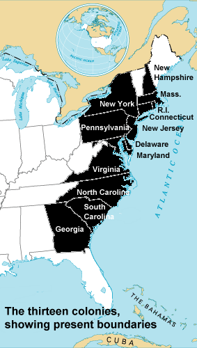
English: The original 13 colonies of the United States. |
| Date | |
| Source | |
| Author |
|
Jengod, the copyright holder of this work, hereby publishes it under the following licenses:
| This file is licensed under the Creative Commons Attribution-Share Alike 3.0 Unported license. Subject to disclaimers. | ||
| Attribution: Jengod | ||
| ||
| This licensing tag was added to this file as part of the GFDL licensing update.http://creativecommons.org/licenses/by-sa/3.0/CC BY-SA 3.0Creative Commons Attribution-Share Alike 3.0truetrue |

|
Permission is granted to copy, distribute and/or modify this document under the terms of the GNU Free Documentation License, Version 1.2 or any later version published by the Free Software Foundation; with no Invariant Sections, no Front-Cover Texts, and no Back-Cover Texts. A copy of the license is included in the section entitled GNU Free Documentation License. Subject to disclaimers.http://www.gnu.org/copyleft/fdl.htmlGFDLGNU Free Documentation Licensetruetrue |
This file is licensed under the Creative Commons Attribution 2.0 Generic license.
Attribution: Jengod
- You are free:
- to share – to copy, distribute and transmit the work
- to remix – to adapt the work
- Under the following conditions:
- attribution – You must give appropriate credit, provide a link to the license, and indicate if changes were made. You may do so in any reasonable manner, but not in any way that suggests the licensor endorses you or your use.
You may select the license of your choice.
Original upload log
The original description page was here. All following user names refer to en.wikipedia.
- 2004-10-13 22:03 Jengod 283×500× (63263 bytes) Fix S.C.
- 2004-10-13 21:58 Jengod 283×500× (63075 bytes) {{GFDL}} Derived from {PD-USGov} Image:National-atlas-blank-state-outlines.png
This image is a derivative work of the following images:
- File:National-atlas-blank-state-outlines.png licensed with PD-USGov-Atlas
- 2011-01-29T06:54:29Z File Upload Bot (Magnus Manske) 758x584 (119202 Bytes) {{BotMoveToCommons|en.wikipedia|year={{subst:CURRENTYEAR}}|month={{subst:CURRENTMONTHNAME}}|day={{subst:CURRENTDAY}}}} {{Information |Description={{en|[[:en:Category:United States maps|]]}} |Source=Transferred from [http://e
Uploaded with derivativeFX
Captions
Add a one-line explanation of what this file represents
Items portrayed in this file
depicts
13 October 2004
image/png
32f29163754d684840bf2985cedc7456ec3a2489
63,263 byte
500 pixel
283 pixel
File history
Click on a date/time to view the file as it appeared at that time.
| Date/Time | Thumbnail | Dimensions | User | Comment | |
|---|---|---|---|---|---|
| current | 07:08, 29 January 2011 | | 283 × 500 (62 KB) | Kelly | {{Information |Description={{en|The original 13 colonies of the United States.}} |Source=*File:National-atlas-blank-state-outlines.png |Date={{Date|2004|10|13}} |Author=*File:National-atlas-blank-state-outlines.png: National Atlas of the Unite |
File usage
No pages on the English Wikipedia use this file (pages on other projects are not listed).